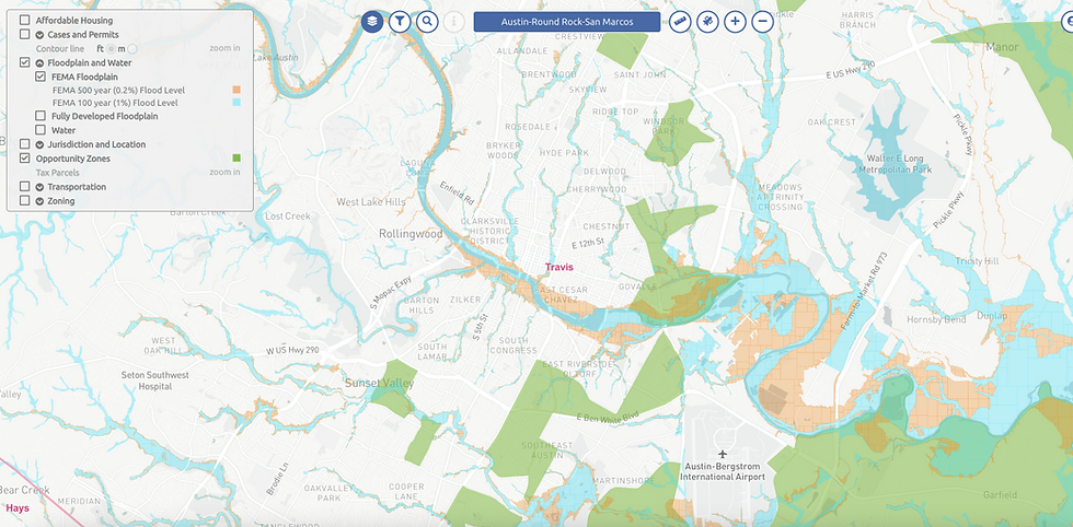
FLOODPLAIN MAP IN AUSTIN-ROUND ROCK-SAN MARCOS
VIEW MAPS WITH AN OVERLAY OF THE FEMA 100 YEAR AND 500 YEAR FLOODPLAIN AND AUSTIN FULLY DEVELOPED FLOODPLAIN, AS WELL AS A WATER OVERLAY
Sign up to see the full interactive map. Use promo code TEXASCREDATA9J6 for a 7-days FREE trial!
FEMA Floodplain

Sign up to see the full interactive map. Use promo code TEXASCREDATA9J6 for a 7-days FREE trial!
City of Austin Fully Developed Floodplain


Sign up to see the full interactive map. Use promo code TEXASCREDATA9J6 for a 7-days FREE trial!
Water Map

Sign up to see the full interactive map. Use promo code TEXASCREDATA9J6 for a 7-days FREE trial!
Combine this information with tax parcel data, jurisdiction area, zoning data, or opportunity zone to understand how environmental threats and regional ordinances can impact your current or prospective property.


Start your free trial at FuseGIS to see more data layers for the full Austin & Houston MSAs and filter for certain parcels which meet your criteria.
Sign up to see the full interactive map. Use promo code TEXASCREDATA9J6 for a 7-days FREE trial!
